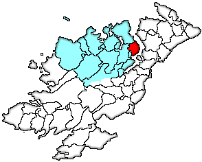
Killygarvan Parish Townlands, Co. Donegal, Ireland
Formatted by
Jim McKane, Ontario, Canada
jamckane[at]gmail.com
Original code by Bob Hilchey
Killygarvan ParishKilmacrenan BaronyPoor Law Union - Millford |
 |
| Communities: | Rathmullan |
| Ecclesiastical Parish: | Roman Catholic | Church of Ireland | Presbyterian | |
| Killygarvan 1868 | Killygarvan 1706 | Rathmullan 1845 | ||
| Rathmullan |
| Townland | Acres |  |
|
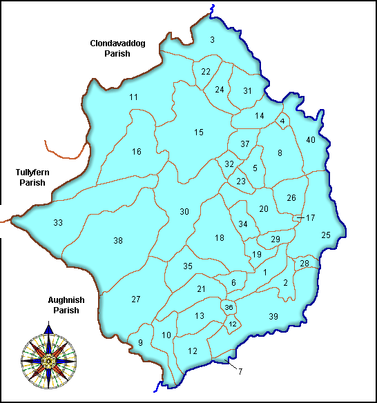
| 1. | Aghavannan Far | 179 | |
| 2. | Aghavannan Near | 102 | |
| 3. | Anny Far & Near | 378 | |
| Ballyboe (Note 1) | 15 | ||
| 4. | Bin | 25 | |
| 5. | Carradoan | 90 | |
| 6. | Carrafeagh | 103 | |
| 7. | Carraleena | 16 | |
| 8. | Clondaltan | 265 | |
| 9. | Craigmaddyroe Far | 139 | |
| 10. | Craigmaddyroe Near | 126 | |
| 11. | Creeveoughter | 846 | |
| 12. | Crevary Lower | 157 | |
| 13. | Crevary Upper | 184 | |
| 14. | Drumhallagh Lower | 149 | |
| 15. | Drumhallagh Upper | 590 | |
| 16. | Elly | 488 | |
| 17. | Glebe | 6 | |
| 18. | Glencross | 395 | |
| 19. | Gortcross | 66 | |
| 20. | Grotflugh | 221 | |
| 21. | Gortlough | 138 | |
| 22. | Inniskill | 95 | |
| 23. | Kerans Town | 60 | |
| 24. | Killycolman | 135 | |
| 25. | Killygarvan Lower | 121 | |
| 26. | Killygarvan Upper | 147 | |
| 27. | Kinletteragh | 527 | |
| 28. | Kinnegar | 32 | |
| 29. | Kintale | 76 | |
| 30. | Legland | 506 | |
| 31. | Lehardan | 169 | |
| 32. | Lugher | 65 | |
| 33. | Lurganboy | 576 | |
| 34. | Maghernakilly | 84 | |
| 35. | Meenreagh | 176 | |
| 36. | Millbrook | 41 | |
| 37. | Newtown Carradoan | 101 | |
| 38. | Oughterlin | 777 | |
| 39. | Rathmullan (Note 1) | 484 | |
| 40. | Saltpans | 262 |
| Note: | 1. | The DYCW has combined Rathmullan and Ballyboe into a single townland, but the IreAtlas database considers them to be two. The areas cited here are for the separate townlands. Combined, they equal 499 acres. |
Back to Main Co. Donegal Map Page
Further Killygarvan Parish records can be viewed here:
Killygarvan Parish Records, Co. Donegal
Can’t find your ancestor?
and
CoTyroneIreland.com Every Word Search