Using Griffiths Valuation Town Maps and PRONI’s Valuation Records Collection: Researching Armar Moffatt of Strabane, Co. Tyrone, Northern Ireland
Submitted by
Roger Cousens, Melbourne, Australia
rcousens[at]unimelb.edu.au
At some point many of us go back to where our Ancestors lived, visit their graves and perhaps try to find the buildings that they lived in. For this, Griffith’s Valuation and its associated maps are invaluable. In rural areas these allow us considerable precision; historical versions of Ordnance Survey maps (now on line for some scales at https://apps.spatialni.gov.uk/PRONIApplication/ ) also allow us to see how things have changed – as long as were are only interested in the mid-nineteenth century onwards. But until recently I was unaware that there were maps that allowed us to see greater detail in towns, at the time of Griffith’s Valuation and showing the householder reference. The extent of my knowledge was what is possible at AskAboutIreland http://www.askaboutireland.ie/griffith-valuation/ and the Valuation Review books at https://www.nidirect.gov.uk/services/searching-valuation-revision-books. I had thought that the town maps used in Griffith’s were only available for Eire (if you access the map on AskAboutIreland, then click on “Show Towns”, you will see symbol for towns in Eire that you can click on to find maps at a finer scale). So where are the equivalents for towns in Ulster counties? I can tell you, but unfortunately it is not on-line. But there is also much more: wonderful things for your next visit to PRONI!
I will explain what I have found out. My interest was in finding out exactly where in Strabane some possible relatives lived. Armar Moffatt of Clabby, Co. Fermanagh married Anne Knox, daughter of James Knox, an innkeeper in Strabane and he moved there around 1780. They owned or leased properties in Strabane, near the Bowling Green. I can find no records of their deaths. Deeds give great detail of locations in relation to other buildings and their owners (some have sketch maps if I can access the originals). Their only child, Mary, married a Greacy (or Gracey) and had at least three children; she then married a Thomas Gilkinson of Clabby, sold up in 1833 and moved back to Clabby with her children. Most of these events were pre-Griffith’s but I hoped to find town maps/plans from around that time.
First, I discovered the Old Strabane blog site http://oldstrabane.blogspot.com/ . There are some interesting maps and photos there, including one for “Strabane tenements” in 1854. It is a hand sketch, but probably taken from the map used for Griffith’s. To access it, I had to open Google Earth, then open Oldstrabane’s .kmz file as a “New Project”. I tried to find out the source from them, but sadly the “Contact Us” email address does not work.
Then I discovered some great instructions on accessing Griffith’s town maps by Bill Macafee: I highly recommend his site http://www.billmacafee.com/ He has a guide showing how he accessed maps of Coleraine in PRONI’s catalogue under VAL/ : http://www.billmacafee.com/valuationrecords/griffrevisions.pdf . It appears to show amazing stuff that we can access on-line. There are “View” links on the PRONI site that I assumed would open the maps….. But alas not! I am told that Bill’s screen-dumps are from an old version of the PRONI eCatalogue, where “View” just means “view more information”
I contacted the PRONI on-line help desk to ask about the Griffith’s town maps. They knew nothing about them and suggested that I access their excellent collection of OS town maps referenced under OS/ in their catalogue but only available at PRONI (currently closed and I am in Australia). For example, OS/9/22/1 is the 1832 map of Strabane at 2 feet to the mile. But these maps do not show the household numbering system used in Griffith’s. I managed to get some advice from one of PRONI’s curators, who told me that the VAL/ maps have never been digitised (only the Revision books) and that Bill had scanned the Coleraine maps himself. I was advised to fill out a form to make an appointment to visit PRONI……. Really disappointing, having had Bill’s example whet my appetite! When will I get to PRONI (Australia is still cut off and slow progress with Covid vaccinations)?
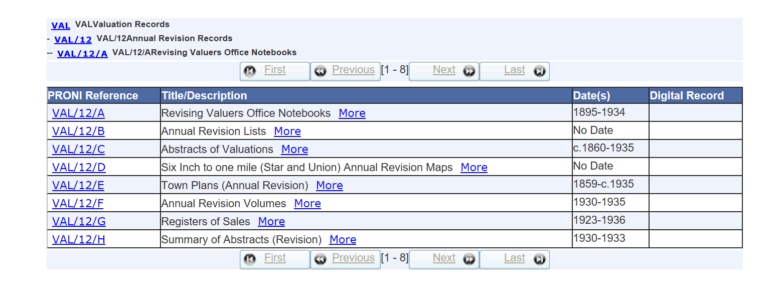
What I did learn from this exercise, however, was the amazing VAL/ resource in PRONI’s files. . I wonder why the extent of this resource is relatively unknown?
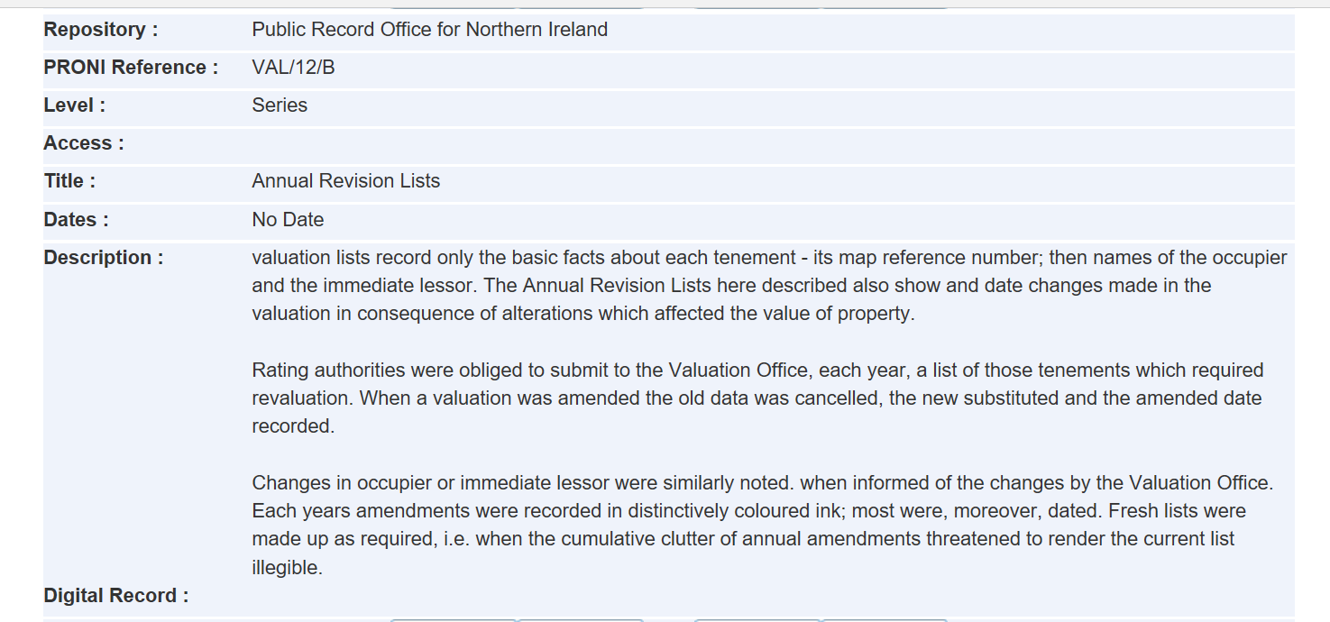
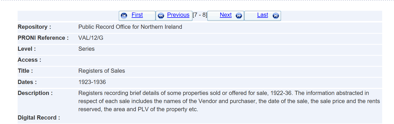
Unfortunately, clicking on “More” tells you little about what the files contain (except for VAL/12, listed at the end of this file). Which probably means that they are rarely accessed! VAL/2 is the main valuation that is presented on AskAboutIreland. Most of Bill’s examples come from VAL/12, the revision books that contain most of the information that you and I would need.
What I did discover is that there are Co. Tyrone town maps under:
VAL/1/D/1 (1834) [sadly not many and not Strabane] all 5 feet to one mile
VAL/2/D/5 (1859) [VAL/2/D/5/18A and 18B for Strabane at 5 feet to one mile]
VAL/3/G (1935-1957) [VAL/3/G/159/1 and 2 for Strabane with three maps in each]
VAL/12/E (various dates, mostly 1860 onwards) [VAL/12/E/187/1 and 2 for Strabane at 10 feet to the mile]
I can’t wait to get the PRONI staff to bring out 10 feet to the mile maps (presumably in several sections)!